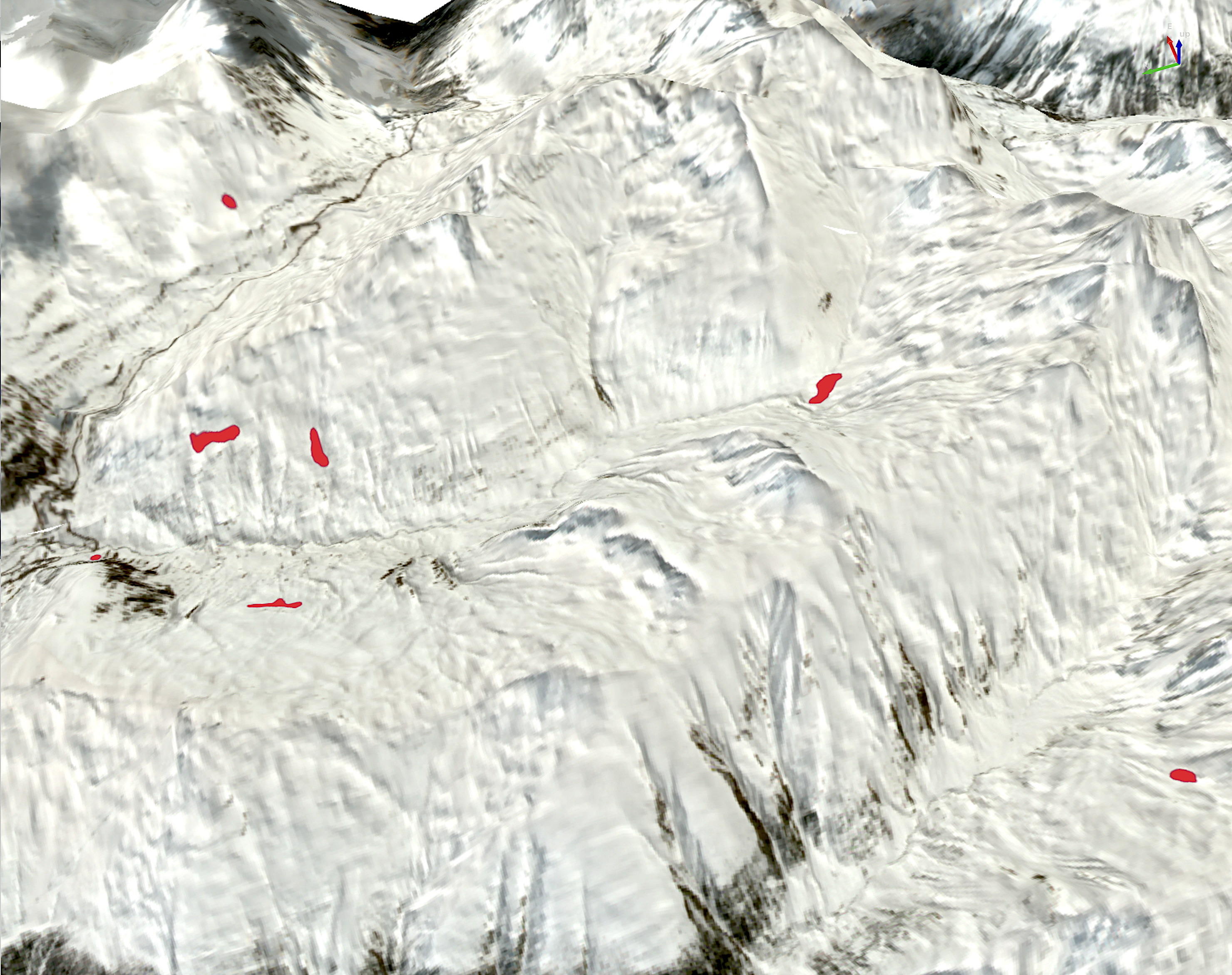
Project developed under the ESA-promoted ARTES 4.0 Business applications, which provides different services through the use of satellite data, GNSS technology, and snow-meteorological data for the development of systems aimed at monitoring avalanche activity, defining snow parameters (snow depth and water content), and monitoring landslides triggered by snowmelt.
PROJECT: the project was developed under the ARTES 4.0 Business applications promoted by ESA to create commercial and sustainable space-based applications that utilize at least one space asset.
CLIENT: ESA (European Space Agency)
STAKEHOLDERS: regional, national, and international institutions, private companies
OBJECTIVE: Development of three commercial services that use satellite data for the automatic monitoring of avalanche activity, the definition of snow parameters (snow depth and water content), and the monitoring of landslides triggered by snowmelt.
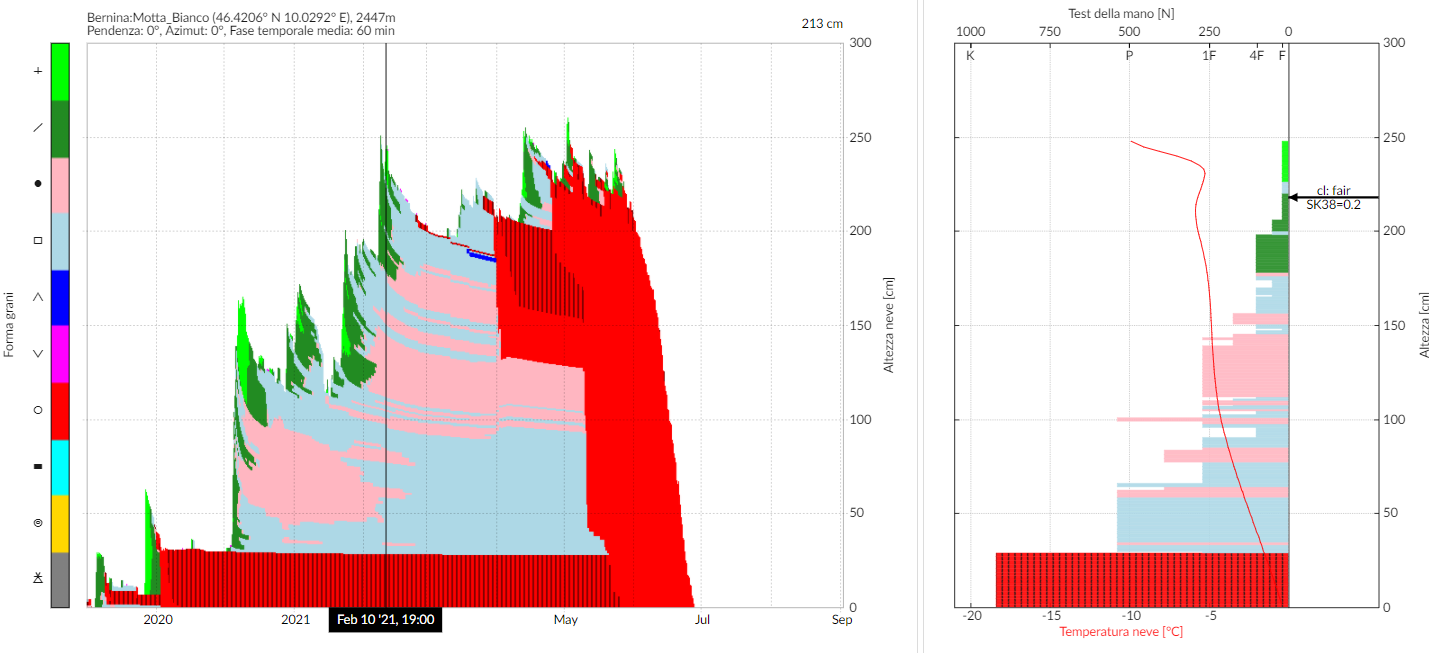
DESCRIPTION: The project is funded by ESA and aims to provide commercial products that make use of at least one space asset. Three application areas have been identified: (i) automatic detection of avalanche activity using satellite data (SAR – Synthetic Aperture Radar), (ii) development of a cheap tool for measuring snow parameters such as snow depth and water content using GNSS technology and satellite data, and (iii) development of a compact and cheap tool for monitoring ground deformations induced by snowmelt using GNSS technology and satellite data.