PROJECT: maps and graphs creation of snow depth on the ground and of Snow Water Equivalent (SWE) to assess water availability;
CLIENT: ARPA Veneto
STAKEHOLDERS: ARPA Veneto, Veneto region, public and private hydropower companies
OBJECTIVE: acquisition of daily information on the availability of water in liquid form (SWE) produced by snowpack melting
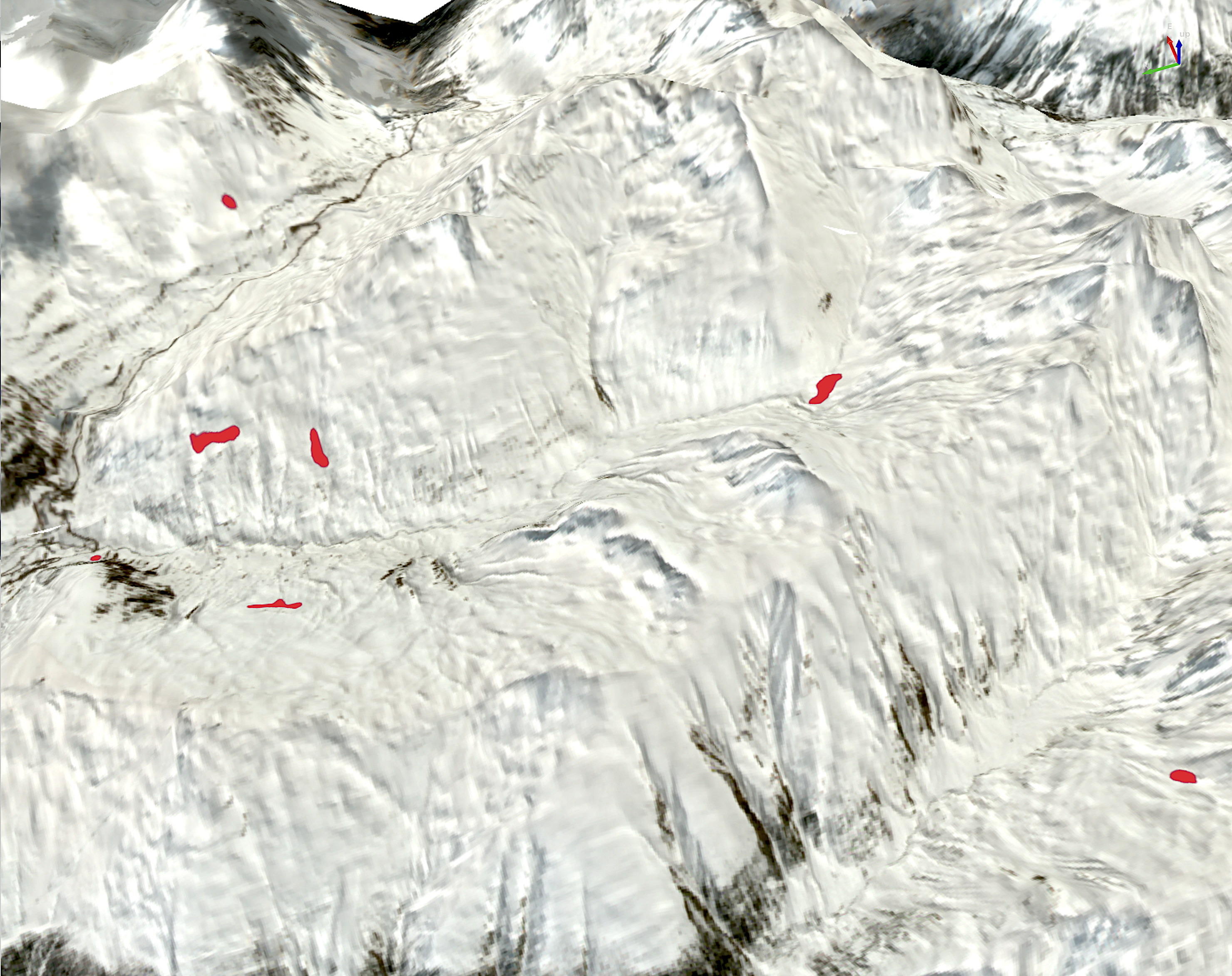
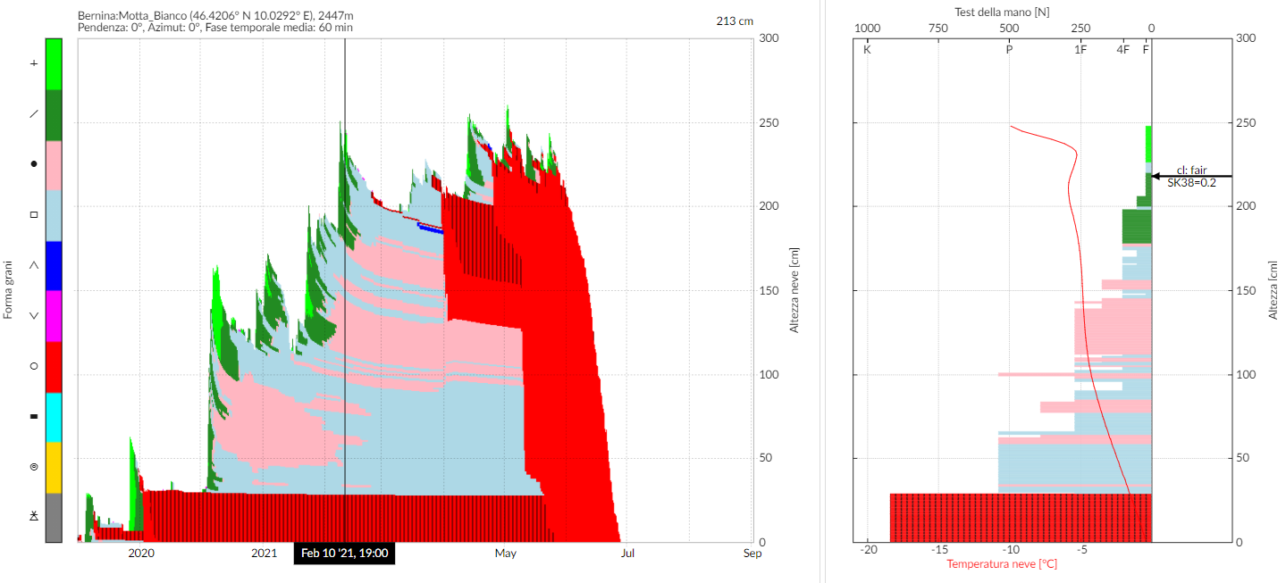
DESCRIPTION: point data from snow weather monitoring stations are processed using the SNOWPACK software to simulate snowpack characteristics. These data, integrated with satellite image analysis and spatial interpolation algorithms, enable the production of daily snow depth (HS) and snow water equivalent (SWE) maps for the entire Veneto Region. The outputs are visualized through a dashboard that allows to query the data both spatially and termporally.