PROJECT: The use of drones provided detailed information concerning the inspection of avalanche starting zones and the monitoring of avalanche barriers. Furthermore, this technology made it possible to reconstruct a digital terrain model of an area subject to hydrological instability. Another project involved the reconstruction of the volumetrics and the relative melting losses of a snow farm during the summer season.
STAKEHOLDERS: APT Livigno, Società private, Comune di Livigno
APPLICATIONS:
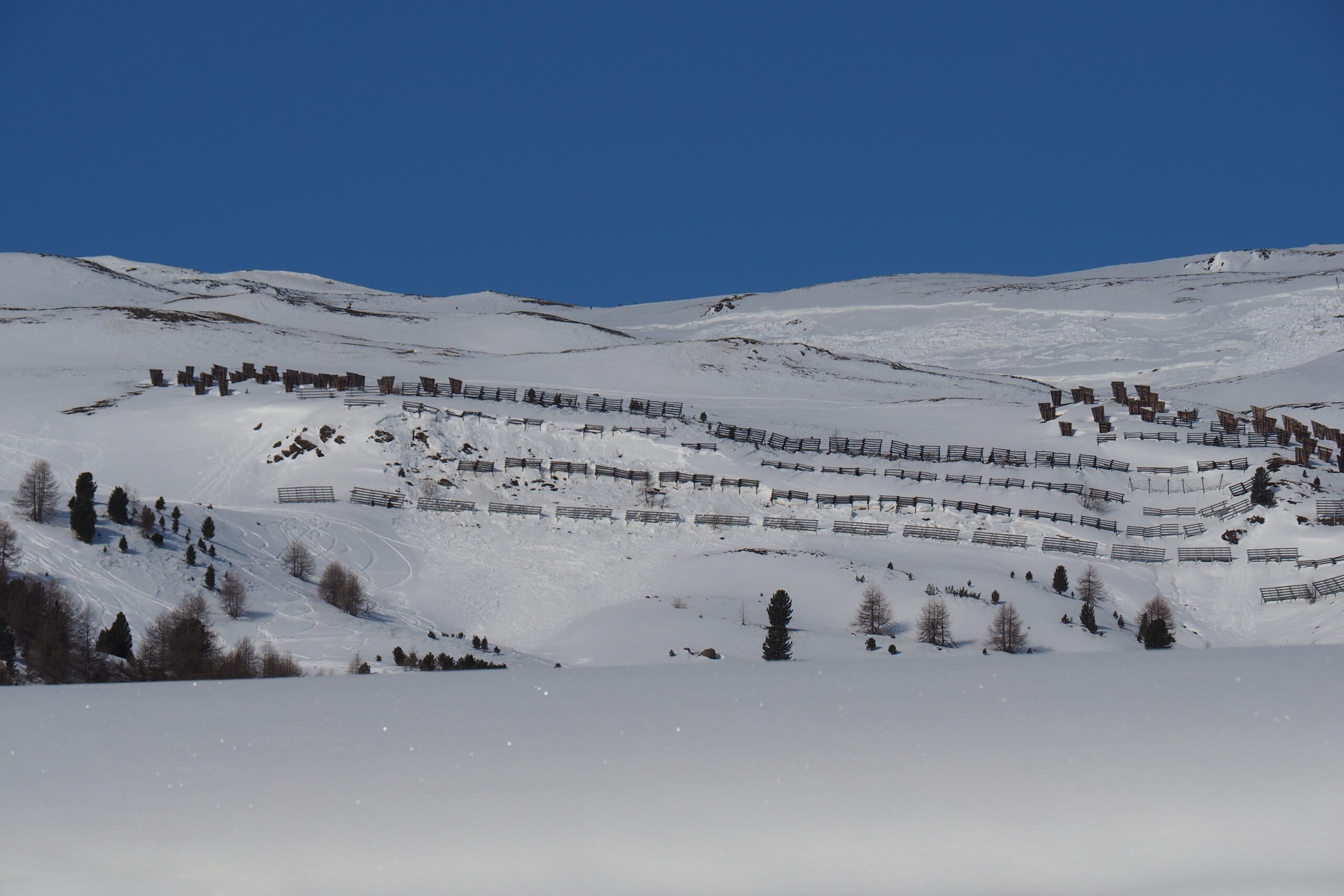
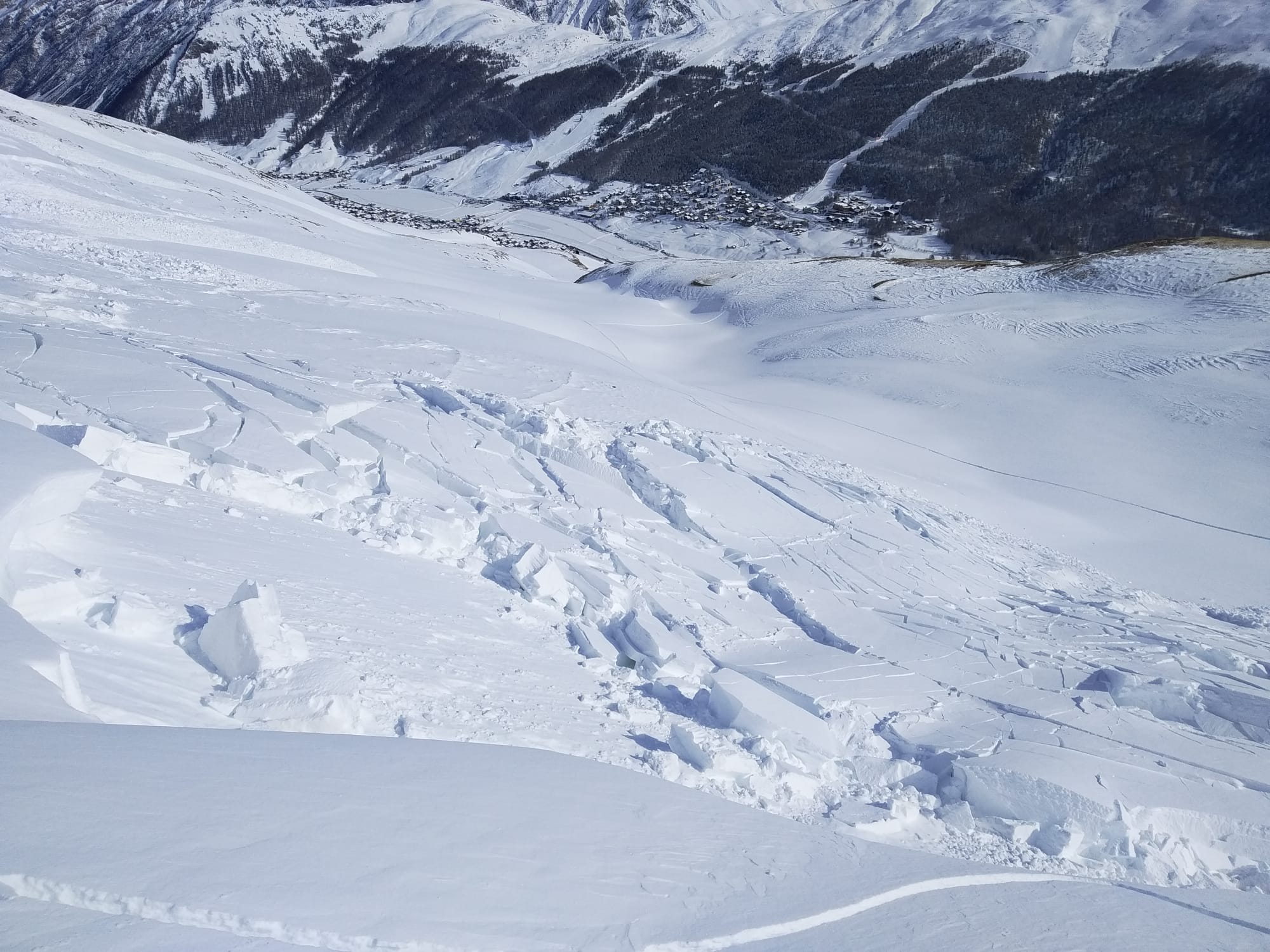
- – Inspection of avalanche release areas (Livigno);
- – Inspection of avalanche defense structures (Livigno);
- – Digital terrain modeling in areas subject to hydrogeological instability (Livigno);
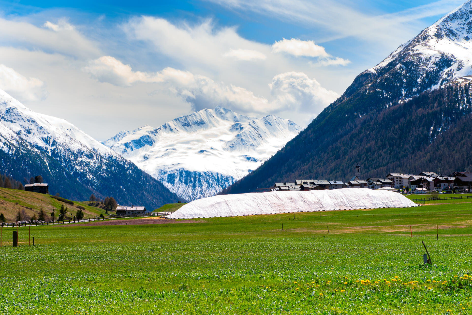
- – Volumetric reconstruction and evolutionary monitoring of a snow farm (Livigno)
DESCRIPTION:
Use of drones to perform ortho-photogrammetric surveys for digital terrain modeling and the production of ortho-mosaics in a mountain environment. Inspection of remote areas subject to avalanche starting zone and of defense structures. Support for snowfarming techniques and ski facilities.
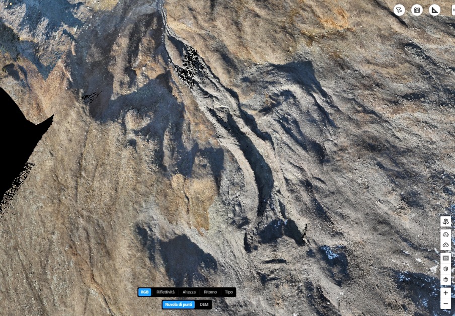
Point cloud relative to a collapsing rock glacier realized with LIDAR and photogramnetric UAV survey
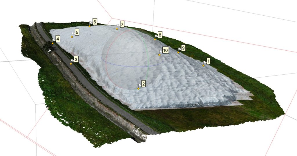
Point cloud of a UAV photogramnetric surveying of the Livigno snowfarm