Application of Remote Sensing tools for the development of algorithms for monitoring various elements of the cryosphere and the alpine environment.
Alpsolut has developed various techniques and algorithms that, through satellite data and terrestrial remote sensing technologies, including drones, provide a wide range of information for monitoring and managing risk and danger in complex contexts such as mountains or remote areas. Remote sensing is a fundamental tool for acquiring information and monitoring the environment, particularly where access is difficult and investigation costs are high.
Alpsolut specializes in the research and development of applications based on Synthetic Aperture Radar (SAR) satellites, with a particular focus on the cryosphere. This technology, which is independent of weather conditions and sunlight, allows us to offer unique services such as:
- – Monitoring and historical reconstruction of avalanches;
- – Spatial data on ground snow depth, Snow Water Equivalent (SWE), and wet snow;
- – Monitoring of ground movements related to landslides and permafrost degradation
Alongside radar data, we use optical satellites at different resolutions and drone surveys, applied to both environmental and forest monitoring and hydrogeological risk assessment.

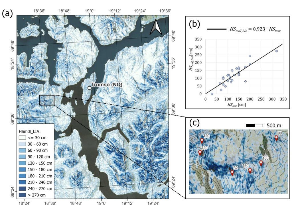
1. Synthetic Aperture Radar snow depth retrieval over Tromso (Norway) validated with in situ observation.

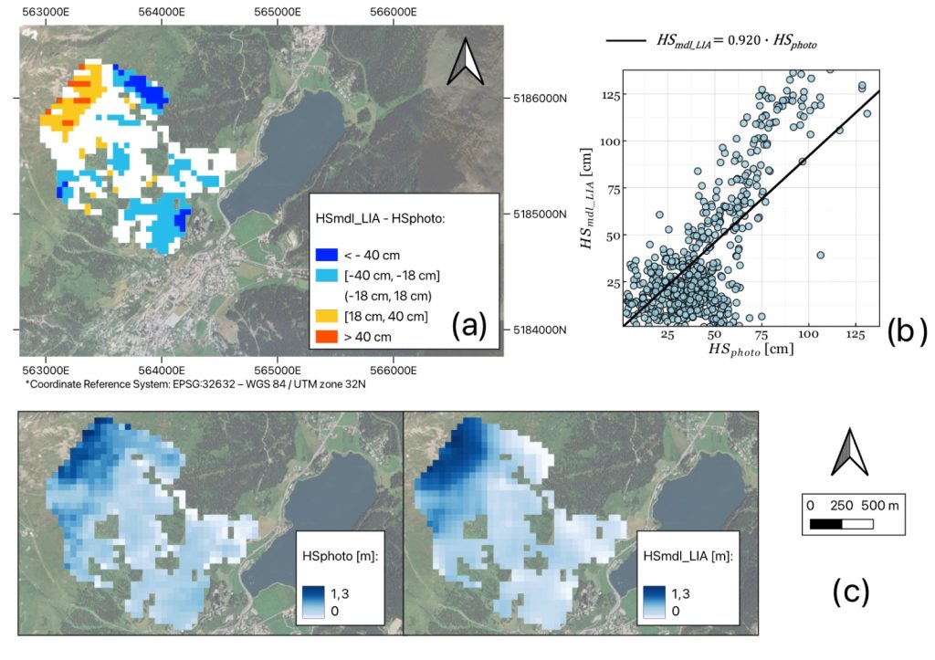
2. Comparison between Snowpack Depth retrieved with Synthetic Aperture Radar and Snowpack Depth from a photogrammetric survey.

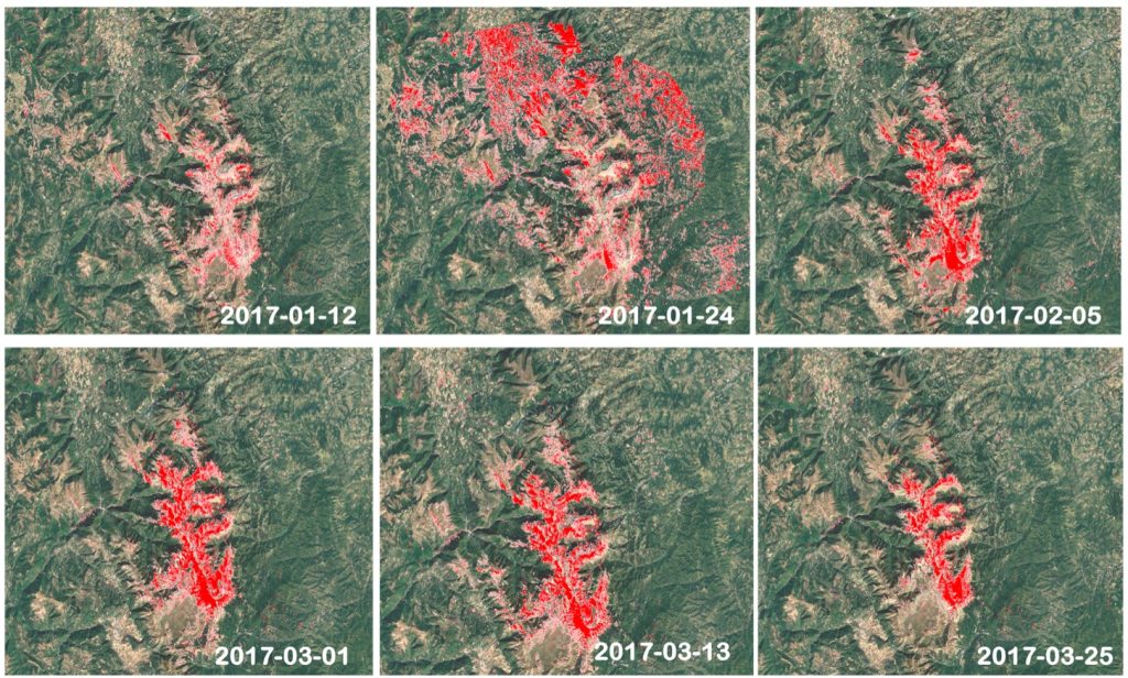
3. Evolution of the presence of wet snow identified from Synthetic Aperture Radar for a mountain range in central Italy.