PROJECT: development of the zoning plan for areas exposed to avalanches for the entire Livigno valley and the Trepalle area.
COMMISSIONING COMPANY: Comune di Livigno
STAKEHOLDERS: Citizens and tourists of Livigno
OBJECTIVE: to define the hazard classes of the boundaries for the entire Livigno valley and the Trepalle area.
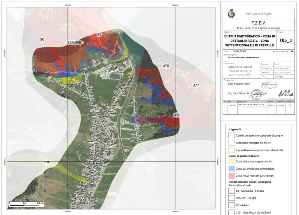
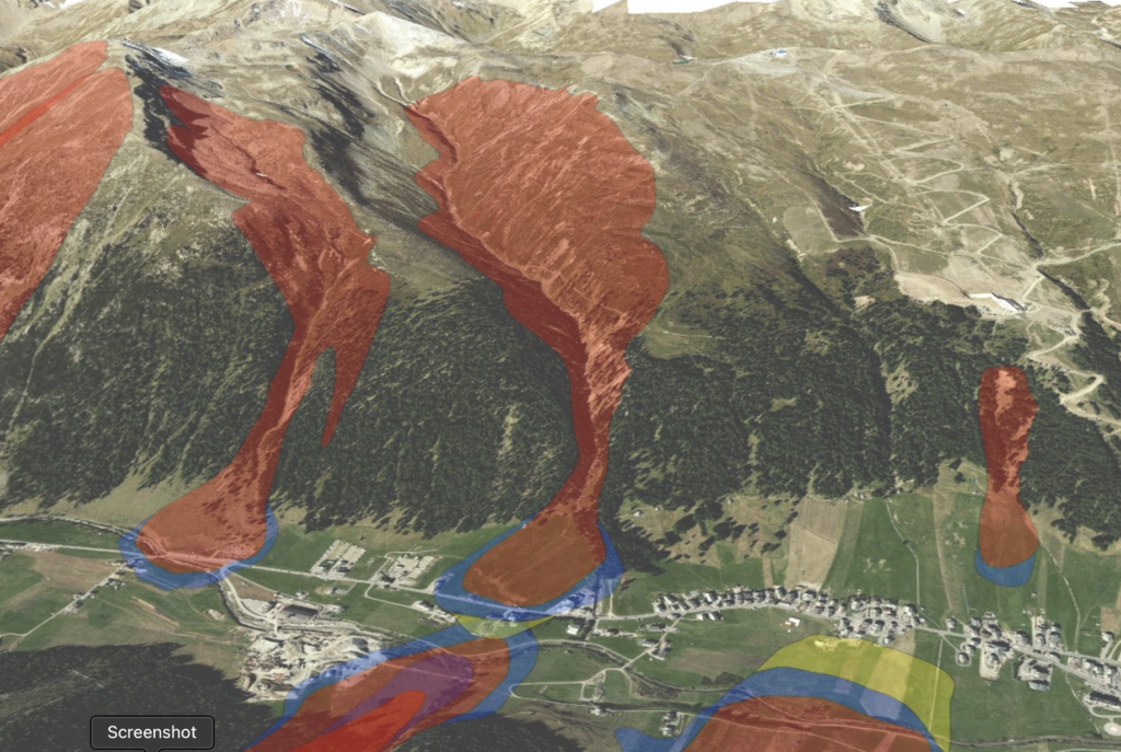
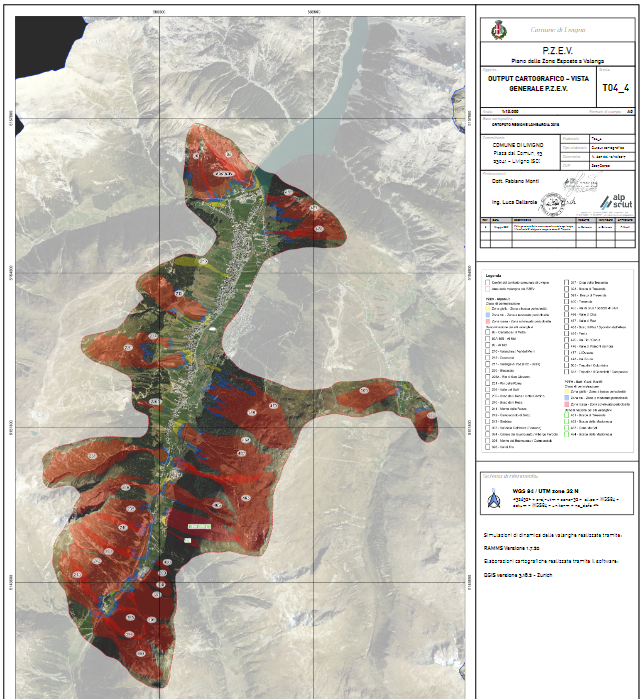
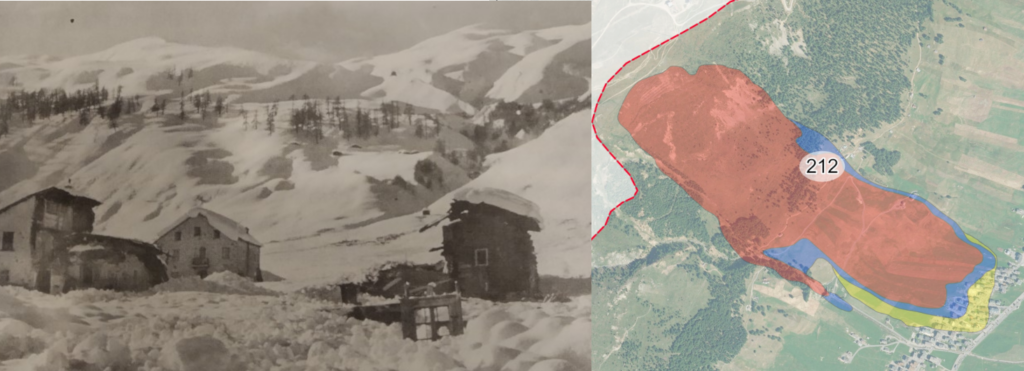
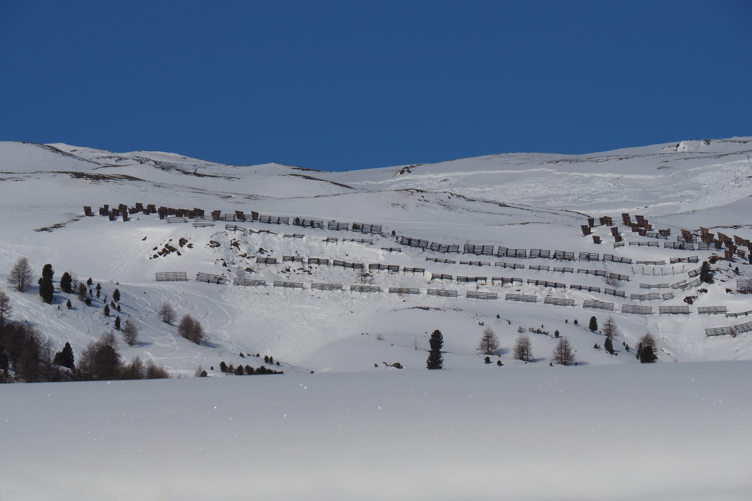
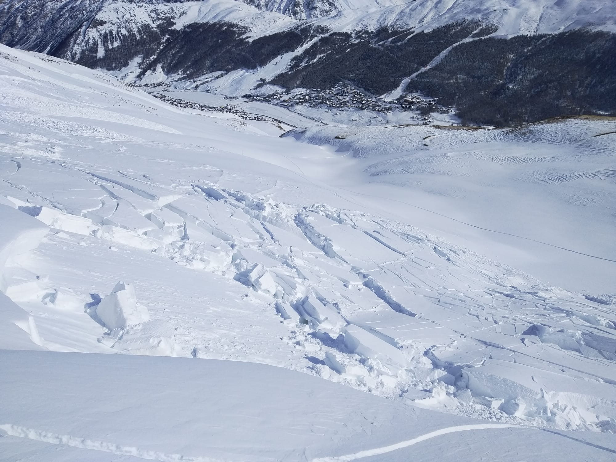
DESCRIPTION: On behalf of Comune di Livigno, a zoning plan was drawn up for areas exposed to avalanches throughout the Livigno valley and the Trepalle area. In order to define the hazard classes of the boundaries, multiple aspects were investigated: historical avalanches, morphological conditions and the outputs of avalanche dynamics simulations. In addition, Indicative Hazard Maps were developed for the entire area in order to assess any risk situations not considered by the CLPV and PZEV.